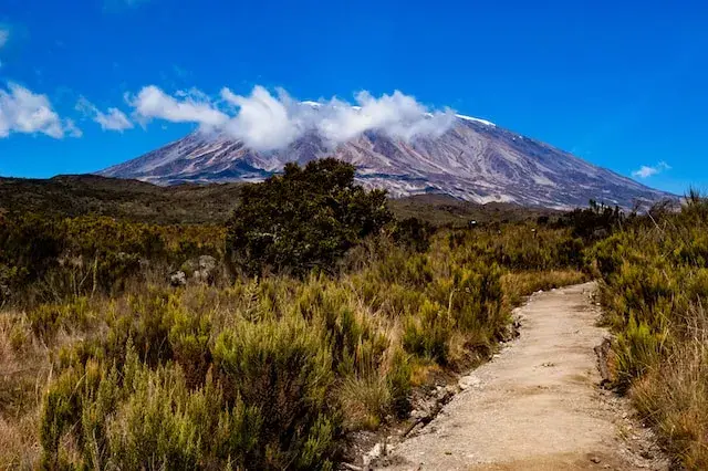
Overview
The Machame Route is known as the “Whiskey Route” in comparison to Marangu’s “Coca Cola Route”. This is because Machame is a more difficult route, and does not have sleeping huts for accomodation. Machame is the second most popular route on the mountain.
Tour Itinerary
Elevation: 1,800 m to 3,000 m / 5,905 ft to 9,843 ft
Distance: 11 km / 6.8 mi
Hiking Time: 5–7 hours
Habitat: Rainforest
Description:
After breakfast, you drive to Machame Gate and register with park rangers. The trail begins through lush rainforest, with birds singing and monkeys swinging in the trees. It’s a steady uphill walk, with soft ground and cool shade. You’ll stop for lunch along the way, then continue to Machame Camp. The forest clears as you arrive, and the mountain starts to show itself.
Elevation: 3,000 m to 3,840 m / 9,843 ft to 12,598 ft
Distance: 5 km / 3.1 mi
Hiking Time: 4–6 hours
Habitat: Moorland
Description:
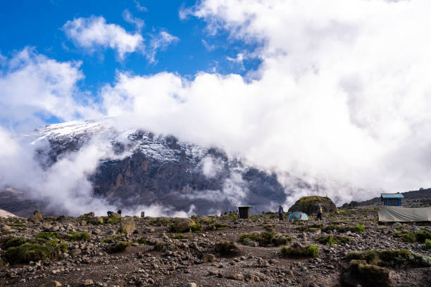
You leave the forest and enter the moorland zone. The trail climbs steeply at first, then opens up to wide views and strange plants. You’ll pass giant heathers and volcanic rock formations. The air gets cooler and thinner, but the scenery is stunning. By afternoon, you reach Shira Camp, with views stretching across the plateau.
Elevation: 3,840 m to 4,600 m to 3,976 m / 12,631 ft to 15,091 ft to 13,044 ft
Distance: 10 km / 6.2 mi
Hiking Time: 6–7 hours
Habitat: Alpine Desert
Description:
This is a big day for acclimatization. You climb up to Lava Tower, a tall rock at high altitude. It’s tough, but helps your body prepare for the summit. After lunch, you descend to Barranco Camp in a deep valley. The cliffs and giant plants around you feel surreal and beautiful.
Elevation: 3,950 m to 4,673 m / 12,959 ft to 15,331 ft
Distance: 9 km / 5.6 mi
Hiking Time: 7–9 hours
Habitat: Alpine Desert
Description:
You start by climbing the Barranco Wall—a steep but fun scramble with amazing views. Your guides help you navigate safely to the top. From there, you walk through valleys and ridges with glaciers in the distance. You’ll stop at Karanga for lunch, then continue to Barafu Camp. This is your final stop before the summit.
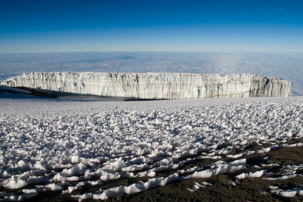
4,673 m to 5,895 m to 3,068 m / 15,331 ft to 19,341 ft to 10,065 ft
Distance: 17 km / 10.6 mi
Hiking Time: 12–14 hours
Habitat: Arctic to Rainforest
Description:
You wake in the dark and begin the final climb with headlamps. It’s cold and steep, but you move slowly and steadily. At sunrise, you reach Uhuru Peak—the highest point in Africa. You celebrate, take photos, and feel proud. Then you descend all the way to Mweka Camp for a well-earned rest.
Elevation: 3,068 m to 1,640 m / 10,065 ft to 5,380 ft
Distance: 10 km / 6.2 mi
Hiking Time: 3–4 hours
Habitat: Arctic to Rainforest
Description:
Your final day takes you through lush rainforest, alive with birdsong and fresh mountain air. The trail is soft underfoot, and the descent is gentle. At Mweka Gate, you’ll sign out and receive your summit certificate. A short drive returns you to Moshi, where a hot shower, cold drink, and celebration dinner await.
INCLUDES
All park fees (camping fees, concession fees, entrance fees, & rescue fee)
Accommodations 2 nights before and after the trek
All government Taxes
Trekking Crew (Porters, Cook and professional guide)
Camping equipment’s (Tents, Mattress, Chairs, & Tables)
Private Toilets
Meals & Drinking water
EXCLUDES
Tipping’s for the crew
Personal Items (Visa, Souvenirs, Passport etc.)
Flights
6 Day Machame Route
- Duration: 6 Days / 5 Nights
- Group Size: 2–12 climbers